When residents of Oakland, California were urged to contain the spread of COVID-19, overnight the city saw a new demand for space in which to be active while remaining socially distanced. Lakeside paths and public parks became overcrowded and the City of Oakland Department of Transportation (OakDOT) received calls from local advocacy groups and city officials to close streets surrounding these popular areas. In response, in April 2020 city authorities transformed 21 miles of streets into pedestrian corridors to keep residents safe.
How? The City of Oakland used a community mapping exercise (recently carried out to update the city’s cycling plan) that included expanding existing neighbourhood bike routes to improve options for walking and cycling through the city. Vetted by engineers, partner agencies, city officials and with the input of 3500 local residents, the plan set out a network of 21 miles of mainly residential “slow streets” that avoided bus routes and high traffic zones, roads that intersected with public transport routes, and roads that were key routes for emergency services.
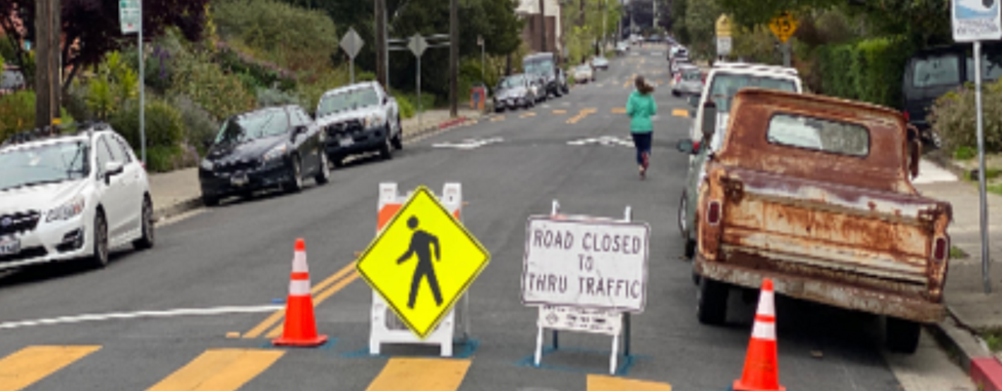
The city rented cheap, small-scale signs and barriers to notify drivers that they could not enter these roads, while local maintenance workers and a self-organized community group regularly checked the streets to ensure that signs and barriers remained in place and were not damaged. The city also entered talks with Google maps to advise drivers not to take routes that had been cordoned off. Community feedback, via surveys, has been carried out to get public input and perception, and to date the majority of feedback has been positive. Whilst data on traffic impacts on adjacent streets is not available, as of August 2020 there had been no fatal or severe pedestrian or cyclist-related crashes on any of the Oakland Slow Streets.1
How might this initiative contribute towards a “better normal” of city life post pandemic? Slow Streets – an initiative that reflects the city’s commitment to promoting safe active transport and physical activity – has received an overwhelmingly positive response from locals and has prompted the City of Oakland to prioritize infrastructure that supports safe access to essential services, particularly for streets with the highest level of traffic collisions. The city also intends to focus on strengthening the Slow Streets network for marginalized and disadvantaged communities most affected by the pandemic. As movement restrictions lessen and business and social activities resume, the City of Oakland is exploring options for making a subset of the changes permanent where evaluation shows that they are meeting community needs.
Local data on COVID-19 cases and deaths by race and geographic area showed that residents living in East Oakland, and communities of colour, were disproportionately affected by the pandemic. Reaching out to these communities is now a high priority for the programme in order to better understand their health and transportation needs.