Washington D.C., 2 December 2025 (PAHO/WHO) — As part of the ongoing technical cooperation between the Pan American Health Organization/World Health Organization (PAHO/WHO) and national institutions, and in celebration of World Geographic Information Systems (GIS) Day, a virtual technical session was held in collaboration with Esri to strengthen operational capacities in the use of artificial intelligence (AI) and deep learning for preparedness and response to public health emergencies and disasters.
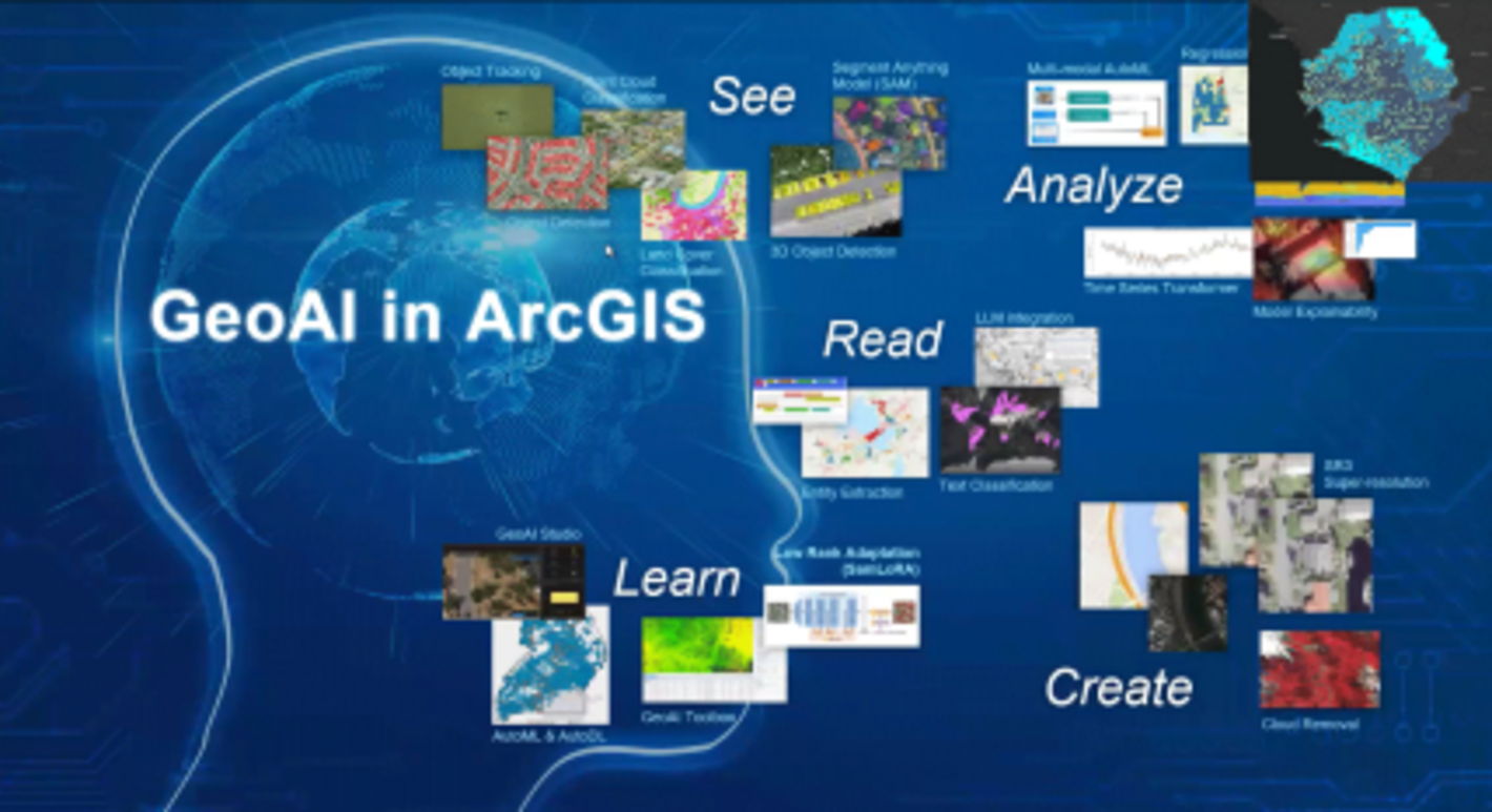
The 1.5-hour webinar, delivered in English with simultaneous interpretation into Spanish, introduced participants to recent advances in GeoAI, combining GIS with AI technologies to enhance emergency decision-making and hazard detection. The session covered the evolution of feature extraction (from manual digitization to machine learning and deep learning) and demonstrated how these techniques enable faster, more automated analysis of satellite, aerial, drone, and field imagery. Participants also explored ArcGIS Pro’s deep learning tools, including object detection, pixel classification, and change detection, along with pretrained models such as land cover classification and road extraction that accelerate emergency mapping.
The webinar also highlighted the growing role of AI assistants across ArcGIS applications. Participants learned how Survey123’s smart assistants support rapid field data collection by automating survey creation and improving data quality. Additional demonstrations showed how generative AI and large language models (LLMs) are being integrated into ArcGIS to streamline workflows, support prompt-based mapping, recommend tools, and enable multimodal analysis of text, imagery, and spatial data.
A total of 33 participants from 19 countries, including staff from PAHO/WHO Country Offices and professionals from Ministries of Health working in health emergencies and epidemiology, took part in the session. Overall, 75 professionals registered for the event. Attendees expressed strong appreciation for the webinar, highlighting its clarity, practicality, and direct relevance to their daily work.
This training is part of the Strategy on Epidemic Intelligence for Strengthening Early Warning of Health Emergencies (2024–2029), supporting Action Line 2, which focuses on the development of technical capacities. By promoting the operational use of artificial intelligence and geospatial technologies, PAHO supports countries in improving emergency readiness and strengthening their ability to detect and respond to hazards more efficiently.
Initiatives such as this mark an important step toward modernizing disaster risk management in the Americas. The incorporation of AI-enabled geospatial tools promotes more agile, precise, and evidence-based decision-making, ultimately helping protect lives and health systems in the face of increasingly frequent and severe emergencies.